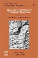
Remote Sensing of Geomorphology
 -10%
portes grátis
Remote Sensing of Geomorphology
Mudd, Simon M.; Tarolli, Paolo
Elsevier Science & Technology
04/2020
398
Mole
Inglês
9780444641779
15 a 20 dias
830
Descrição não disponível.
1. Structure from Motion photogrammetric technique 2. Topo-bathymetric airborne lidar for fluvial geomorphology analysis 3. Ground-based subsurface remote sensing 4. Topographic data from satellites 5. Linking life and landscape with remote sensing 6. Structure from Motion photogrammetry for GeoArchaeology 7. Landslide analysis using laser scanner 8. Terrestrial Laser Scanner applied to fluvial geomorphology 9. Remote sensing for the analysis of anthropogenic geomorphology: potential responses to sediment dynamics in the agricultural landscapes 10. Using UAV and LIDAR data for gully erosion/deposition monitoring 11. Zero to a trillion: Advancing Earth surface process studies with open access to high resolution topography 12. Reproducible topographic analysis
Este título pertence ao(s) assunto(s) indicados(s). Para ver outros títulos clique no assunto desejado.
3D point clouds; Agricultural terraces; Applied geophysics; Archeological sites; Bathymetry; Classification; Connectivity; Cyberinfrastructure; DEM; Digital terrain models; Electrical and electromagnetic methods; Environmental geophysics; Erosion; Geoinformatics; Geomorphic change detection; Geomorphology; Global datasets; Grain size; Green laser; Gully erosion; Highresolution topography; Humans; Hydrogeophysics; Landscapes; Landslides; LASER scanner; Lidar; LiDAR; Mapping; Monitoring; NE Romania; Nearsurface geophysics; Open science; Prehistoric agricultural terraces; Radar; Remote sensing; Replication; Reproducibility; Resolution; River; Satellite; Satellites; Seismics; SfM; Soil erosion; Structure from motion; Surface processes; TerrACE project; Topographic analysis; Topography; UAV; Unmanned aerial vehicles; Vegetation

